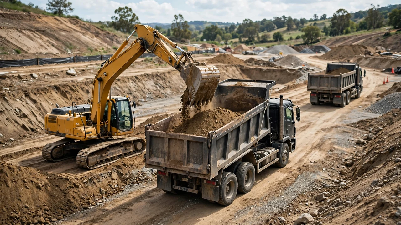
A pond excavation goes wrong on paper before anything goes wrong in the ground. The bank volume gets ordered as truckloads, blended soil gets one swell factor, topsoil disappears into the export count, the maximum depth stands in for the average, and the liner gets sized from a sketch. Each of the 8 mistakes below changes a number on the order. Fix them on paper before the dig starts.
What goes wrong most often with a pond excavation quantity?
The same short orders repeat: bank volume used for haulage instead of loose volume, one swell factor for blended soil layers, topsoil counted with export soil, maximum depth used as the average depth, side slopes left out of the bowl volume, no test pit so water and rock become surprises, one quoted truck capacity treated as universal, and liner sized from the sketch without the anchor-trench overlap.
Use the pond measurement guide for the bank volume method, the soil considerations guide for the swell ranges and soil streams, and the haulage and ordering guide for the load count, payload check, and liner formula referenced below.
1. Ordering truckloads from the bank volume
Trucks carry loose volume, which is larger than the bank volume by the swell percentage. A 150 yd³ bank clay dig at a stated 30% swell becomes 195.0 yd³ loose. At a stated 10 yd³ per load, the bank number orders 15 loads and the loose number orders 20. Five loads are missing.
Fix: convert bank to loose first, then divide by the hauler's stated usable capacity per load. Keep trucks on loose volume only.
2. Using one swell factor for blended soil layers
A pond cut passes through topsoil, clay, and sometimes sand in one dig, and each layer swells differently. Published planning ranges run 15-25% for loam, 20-40% for clay, and 20-30% for sand. One blended percentage hides which layer's assumption is wrong, and the next estimator cannot tell.
A 150 yd³ dig with 20 yd³ of topsoil at a stated 15% swell and 130 yd³ of clay at a stated 30% swell gives 192.0 yd³ loose. A single 30% factor on the blended 150 yd³ gives 195.0 yd³: close on the total, but the topsoil stream is gone from the record.
Fix: keep one line per soil stream with its stated swell assumption. Each line can be revised without touching the others.
3. Counting topsoil in the export stream
Topsoil is a finishing material for final grading, seeding, and planting around the pond. It performs poorly as structural fill and cannot serve as a pond seal. One load count that mixes it with export soil overstates the fill available and understates the topsoil needed back later.
Fix: strip topsoil first and stockpile it separately. Give it its own load count and its own line in the plan.
4. Multiplying the top area by the maximum depth
The deepest point of a pond is not its average depth. A rectangular bowl 20.0 by 12.0 m at 2.5 m depth gives 600.0 m³ when the top area is multiplied by the maximum depth; the frustum volume with measured bottom dimensions is 388.32 m³. The shortcut overstates the dig by 54.5%.
Fix: use the measured bottom dimensions or side slopes with the frustum form, or the grid method for irregular bowls. Record depths at several points, not one.
5. Measuring the top outline and ignoring side slopes
Slopes taper the bowl, so the dug volume is much smaller than the top outline times depth. A 20.0 by 12.0 m top with 3:1 side slopes and 1.5 m depth has a bottom of 11.0 by 3.0 m. Top area times depth gives 360.0 m³; the frustum volume is 181.0 m³. Ignoring the slopes roughly doubles the number.
Fix: record the side slope or the bottom dimensions with the top dimensions. The bottom follows from the slope: bottom length = top length - 2 × slope × depth.
6. Skipping the test pit
Water and rock change both the quantity and the handling. A USDA NRCS engineer recommends digging the test pit to the desired depth in the dry season: gray soil means the ground stays wet year-round, and bedrock is high risk because water moves through its fractures. Rock swells 40-80%, far above soil, and rock that needs blasting is a different quantity altogether.
Fix: dig the test pit before the quantities are frozen. Record rock and wet zones as their own quantities with their own swell and handling notes.
7. Treating one quoted truck capacity as universal
Usable capacity is quoted per hauler and per truck, and it can shrink under legal payload limits. The federal limit on the Interstate System is 80,000 lb gross vehicle weight, with 20,000 lb on a single axle and 34,000 lb on a tandem axle (23 CFR 658.17); state limits govern other roads. The payload is the gross rating minus the truck's tare weight, and the hauler's box may hold more volume than the legal payload allows.
Fix: ask the hauler for the usable capacity per load in writing and keep it as a stated assumption on the plan. Confirm it before the first truck is booked.
8. Sizing the liner from the sketch and forgetting the overlap
Liner sizing uses the measured maximum depth, and the overlap covers the anchor trench and edge fixing. Supplier guidance gives liner length = pond length + 2 × max depth + stated overlap, and the same for width. A 20 by 12 ft pond at 4 ft maximum depth with a stated 2 ft overlap needs 30 by 22 ft, which is 660 ft². Sized from the sketch without depth and overlap, 28 by 20 ft, it is 560 ft²: 100 ft² short.
Fix: size the liner from the measured maximum depth with the overlap stated on the order, then check the result against the supplier's sheet sizes. Irregular ponds need the tape-measure layout method instead.
Safety and professional scope
Excavated spoil and equipment must be kept at least 2 feet from the excavation edge (OSHA 29 CFR 1926.651(j)(2)). Excavation hazards include cave-ins. Quantity planning does not replace an excavation safety plan, project drawings, specifications, permits, codes, or a qualified professional. Where pond design affects drainage, groundwater, or a dam, a licensed engineer owns those decisions.
Sources and scope
- U.S. Office of Surface Mining Reclamation and Enforcement, Directive TSR-1 Appendix A: bank, loose, and compacted are separate material states; swell is the volume increase from excavation.
- Engineering Toolbox, "Soil and Rock - Bulk Factors": swell planning ranges (clay 20-40%, earth 20-30%, loam 15-25%, sand 20-30%, gravel 20-30%, rock 40-80%). Planning ranges only; project values need verification.
- Maine Organic Farmers and Gardeners Association, "What Do You Need to Consider for a Good Pond?" by Candace Gilpatric, PE (USDA NRCS), published summer 2025: test pit to desired depth in the dry season, gray soil stays wet year-round, bedrock risk, 12-inch compacted clay seal, synthetic liners need subsurface drains. Pond siting scope.
- University of Missouri Extension, Pond Construction and Management Considerations (cites USDA NRCS Agricultural Handbook 590): 3:1 or flatter side slopes for new pond embankments. Embankment practice, not an excavation-design rule.
- OSHA 29 CFR 1926.651 (trenching and excavation requirements): spoil and equipment setback, protective systems, cave-in hazards. U.S. workplace scope.
- 23 CFR 658.17 (Federal Highway Administration): 80,000 lb maximum gross vehicle weight on the Interstate System, 20,000 lb single axle, 34,000 lb tandem. Interstate and reasonable access only; states set other road limits.
- smart-pond.com, liner sizing guidance: liner length and width formulas with stated overlap. Supplier guidance, not a standard.
- Wild Essex (wildessex.net), wildlife pond construction guidance: strip topsoil first and stack it separately. Topsoil-handling practice.
- NIST Handbook 44, 2026 Appendix C: unit relationships (1 m³ = 35.3147 ft³ = 1.30795 yd³; 1 yd³ = 27 ft³).
Review responsibility: Saleem Sial owns the published calculation, source, and editorial checks. Waseem Sial, External Reviewer and Engineer, remains listed for ongoing external review; no completed external-review date is claimed.
Next, read the pond measurement guide for the field numbers behind these checks, the soil considerations guide for the swell ranges used above, the haulage and ordering guide for the load count and liner formula, or return to the Earthwork & Drainage Calculators hub.