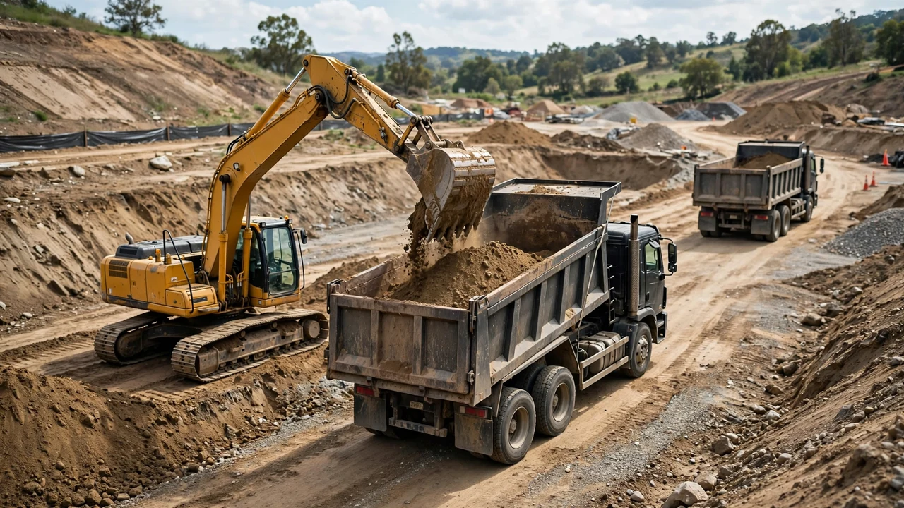
The calculation method decides what you must measure and what number you can defend. A quick site average feeds an early budget; a grid or a cross-section set feeds an order or a payment certificate. This guide compares the four calculation routes side by side on one site so the choice is visible before you commit to the arithmetic.
Which cut-and-fill calculation method fits your project?
Match the method to the data you have, the terrain, and the use of the number. The four routes:
- Direct formula: site area times a single mean depth. Screens an early budget on simple ground.
- Grid cells: the site divided into cells, existing and proposed levels at the nodes, mean corner depth per cell times cell area. Fits broad sites with spot levels and mixed cut and fill.
- Cross-sections: cut and fill areas plotted at stations along an alignment, average end area (or the pyramidal case at zero ends) between adjacent sections. Fits roads, corridors, and any project whose pay specification names the method.
- Surface model: two checked elevation models compared over the same boundary, with the cut/fill map inspected. Fits detailed survey data and complex geometry.
The direct answer for most small simple sites: use a grid broken at every grade change, because it keeps gross cut and gross fill separate with modest effort. Use cross-sections when the alignment or the specification requires them, and a surface model when you already hold the survey data it needs. The sections below show how each choice changes the number.
What does each method need from you?
Choose the method whose inputs you actually hold. A more detailed tool cannot recover terrain that was never measured.
| Method | What you need on hand | Where it works | Where it fails |
|---|---|---|---|
| Direct formula | Site area and one representative depth | Early budgets on flat, simple ground | Mixed cut and fill net against each other into one number |
| Grid cells | Existing and proposed levels at grid nodes | Broad sites with spot levels, terraces, mixed operations | Coarse grids, or mixed-sign cells that average cut against fill |
| Cross-sections | Plotted profiles and cut/fill areas at stations | Roads, ditches, corridors, pay quantities under DOT specs | Sections that skip abrupt geometry changes between stations |
| Surface model | Two checked surfaces, matched boundary, datum, and units | Detailed survey data, complex geometry, large sites | A wrong breakline or datum repeated with high precision |
Use the cut-and-fill volume guide for the formulas and checks behind each row, and the field measurement guide to collect the readings they need.
How does the choice change the number on one site?
One hypothetical pad, 40 m by 30 m. The west half cuts at 1.0 m, the east half fills at 0.8 m, with a sharp terrace hinge at the midpoint. The true block volumes are 600 m³ cut and 480 m³ fill.
| Method | Setup | Result | What it shows |
|---|---|---|---|
| Direct formula | Whole site, one signed mean depth | 120 m³ net cut | The net is numerically right, but both operations vanish from it |
| Cross-sections at 0, 20, 40 m | Sections every 20 m, no transition sections | 300 m³ cut, 240 m³ fill | Linear interpolation across the hinge halves the real volumes |
| Cross-sections both sides of the hinge | Sections at 0, 20, 20, 40 m | 600 m³ cut, 480 m³ fill | Extra sections at the break recover the true volumes |
| Grid split at the hinge | Two 20 m × 30 m cells | 600 m³ cut, 480 m³ fill | Cells broken at the grade change match the blocks |
All four used the same ground. The spread comes from how each method treats the hinge: the direct formula nets the two operations, the coarse sections interpolate across the break, and the resolved grid and sections honor it. Note the check: every resolved method nets to 600 − 480 = 120 m³, the same net the direct formula gave. The net was never wrong. The missing gross numbers were.
Grid cells, sections, and surfaces fail the same way: they smooth across a discontinuity they were never told about. Put the cell edge, the extra section, or the breakline exactly where the ground changes character.
The volume guide works the cell and section arithmetic step by step, including the mixed-sign cell and zero-end fixtures.
What five questions narrow the choice?
- What data do you already hold: a single depth, spot levels, stationed profiles, or two surveyed surfaces?
- Does the ground or the design break sharply anywhere: terraces, walls, ditches, tie-ins?
- Does the governing specification or payment rule name the method?
- What accuracy does the use demand: a budget screen, an order, or a payment certificate?
- What does the effort budget allow: an hour with a spreadsheet, or a survey model?
When does the specification pick the method for you?
For pay quantities on public work, the agency decides. Wyoming DOT's survey manual runs its earthwork workflow on cross-sections with average end areas, including a pyramidal case where an end area is zero. Caltrans uses authorized cross-sections and average-area quantity, and requires project staff to verify planned surfaces and field-check terrain changes before the quantities count.
That rule is a constraint, not a recommendation: when the contract names average end area on authorized sections, a grid or surface number is a second opinion, not the pay quantity. Confirm which method governs payment before choosing the one that feels convenient. The ordering guide takes the accepted geometric quantity into haulage planning; the bank-versus-loose guide converts it between material states.
Method-selection mistakes
- Screening with a site average, then ordering from the net.
- Running a coarse grid and letting mixed-sign cells average cut against fill.
- Spacing sections evenly and skipping the transitions between them.
- Accepting a surface-model total without checking the cut/fill map and extreme depths.
- Choosing the smallest number of the spread instead of the method the ground justifies.
- Comparing bank cut against compacted fill without converting states.
- Running a different method from the one the pay specification names.
Safety and professional scope
Method choice never replaces the project drawings, specifications, or a qualified professional. Quantity planning for structural fills follows the geotechnical report and the project specification, including target density, moisture, and testing frequency. Workers in cut areas need protection under the applicable excavation rules: sloping, shoring, or shielding, with spoil kept back from the edge. For U.S. construction work, OSHA 29 CFR 1926.651 covers excavation safety including protective systems, competent-person inspections, and spoil placement; other countries use their own workplace rules.
Sources and scope
- Wyoming DOT Survey Manual, Appendix F: cross-section, average-end-area and zero-end pyramidal formulas within its survey scope.
- FHWA Central Federal Lands, Earthwork Representation: Grading Summaries & Mass Haul Diagrams: earthwork component, adjustment and plan-representation context.
- Caltrans Construction Manual, Section 4-19 Earthwork: verified ground, authorized cross-sections, average-area quantity and changed-terrain checks.
- Engineering LibreTexts, 7.3 Earthwork: average-end-area, prismoidal, and zero-end pyramid method descriptions (formula listing; not a project specification).
- NIST Handbook 44, 2026 Appendix C: cubic-foot to cubic-yard relationships.
- OSHA Trenching and Excavation: U.S. occupational excavation-safety context.
Scope: the site dimensions, depths, and results are hypothetical arithmetic fixtures verified by independent calculation; they demonstrate how method choice moves the gross numbers and describe no real site. The transportation sources document methods and controls for their agencies and projects; they do not set a universal grid spacing, survey accuracy, material factor, or pay rule. Factor tables, pay rules, and material acceptance remain jurisdiction- and project-specific.
Review responsibility: Saleem Sial owns the published calculation, source, and editorial checks. Waseem Sial, External Reviewer and Engineer, remains listed for ongoing external review; no completed external-review date is claimed.
Next, use the Cut and Fill Calculator to work out the section volumes, then work the chosen method in the cut-and-fill volume guide, or return to the Earthwork & Drainage Calculators hub.