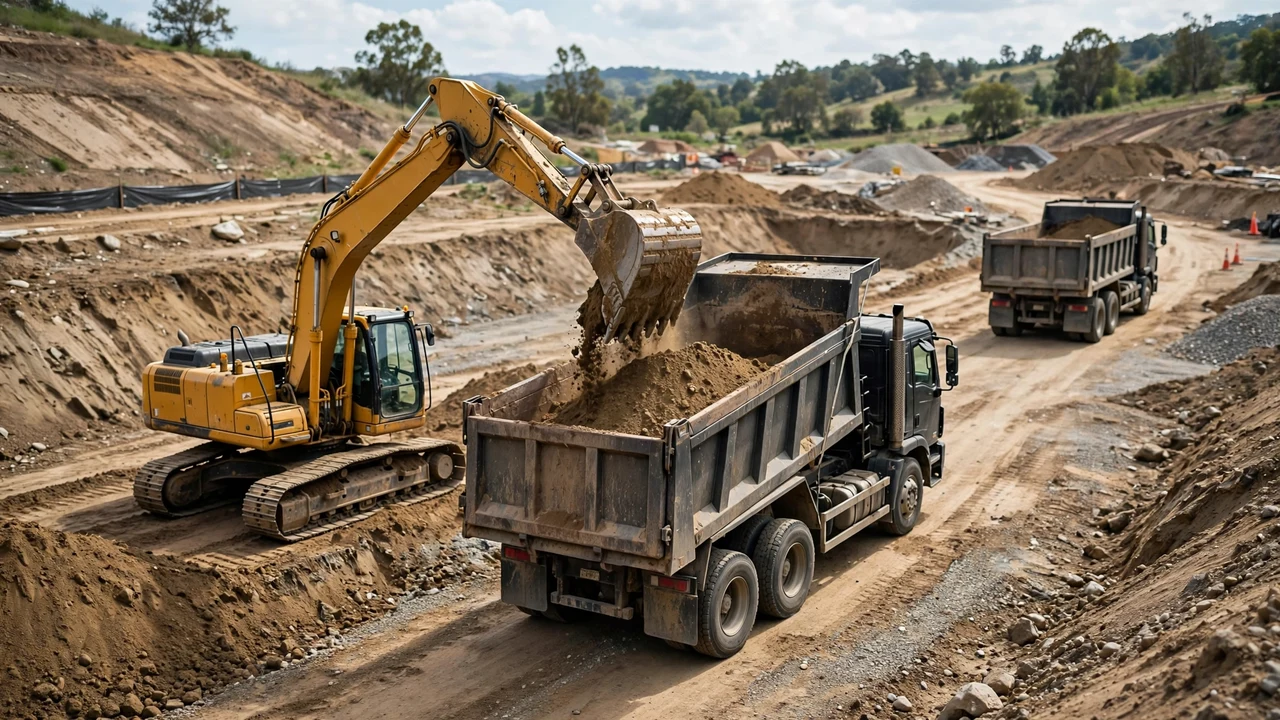
The soil in a pond excavation changes three quantities: how the ground digs, how much soil leaves the site, and what the dug soil can become. Name the soil per layer before converting any volume, and keep each layer's record separate.
How does the soil change a pond excavation?
The soil decides the digging method, the loose volume for haulage, and the after-dig use. Clay digs hard but holds water. Sand digs fast but needs flatter walls and drains. Rock needs ripping or hammering and swells far more than any soil. Topsoil is a finishing material, not a structural one.
| Soil | What it means for the dig | Swell planning range | After the dig |
|---|---|---|---|
| Topsoil | Strip it before the main dig | 15-25% (loam range) | Finishing and planting; not fill or seal |
| Clay | Hard digging, holds shape | 20-40% | Holds water; compacts into a seal |
| Sand | Digs fast, walls cave | 20-30% | Drains freely; plan a liner |
| Loam subsoil | Digs clean, holds shape | 15-25% | Usable general fill |
| Silt | Soft; loses strength when saturated | 20-30% (general soil range) | Poor fill and sealing; keep it out of the pond floor |
| Gravel | Digs like sand, heavier handling | 20-30% | Drains; good for paths, not sealing |
| Rock (blasted or ripped) | Needs ripping or hammering | 40-80% | Bulky fill or disposal |
The swell ranges above are planning ranges from a standard reference table. They are not project factors. Actual swell varies with grain size, moisture, compaction, and excavation method, so confirm the value against the project record or local test data before ordering haulage.
How do you convert the bank volume into loose volume by soil type?
Multiply the bank volume by 1 plus the swell percentage written as a decimal. Pick the swell value from the project record or a stated planning range. A range without a project check is an estimate, not a measurement.
Loose volume = bank volume × (1 + swell % ÷ 100)
Worked metric example: clay
A staked pond measures 120 m³ bank, all clay. The project record supports 30% swell, inside the 20-40% planning range for clay.
- Convert 30% to a decimal: 30 ÷ 100 = 0.30.
- Add 1: 1 + 0.30 = 1.30.
- Multiply the bank volume: 120 × 1.30 = 156.0 m³ loose.
Result: 120 m³ bank becomes 156.0 m³ loose at 30%. The 20% and 40% ends of the range give 144.0 m³ and 168.0 m³, so the swell choice moves the answer by 24 m³ before any truck is counted.
Worked cubic-yard example: sand
The same pond in sand measures 120 m³ bank, which is 120 × 1.30795 = 156.95 yd³. The project record supports 25% swell, inside the 20-30% planning range for sand.
- Convert 25% to a decimal: 25 ÷ 100 = 0.25.
- Add 1: 1 + 0.25 = 1.25.
- Multiply the bank volume: 156.95 × 1.25 = 196.19 yd³ loose.
Result: 156.95 yd³ bank becomes 196.19 yd³ loose at 25%. The 20% and 30% ends give 188.34 yd³ and 204.04 yd³.
Write 120 m³ bank and 156 m³ loose rather than recording two numbers without labels. A swell factor belongs to one named layer, not to the whole pond.
What should you do with the topsoil?
Strip the topsoil before the excavation starts and stockpile it separately. It is the most useful soil on the site: it finishes the grading around the pond and feeds the plants around it. It is the wrong material for a seal, a berm core, or any placed fill that must hold shape.
Estimate the topsoil as its own quantity: top area times average topsoil depth. A 300 m² pond with 0.25 m of topsoil holds 75 m³ bank. Apply the 15-25% loam planning range for its loose record. Keep the topsoil stockpile away from the pond edge and out of the work path.
How do you handle water, rock, and unsuitable layers?
Dig a test pit to the desired depth before the full dig, and do it in the dry season. A site that looks workable in spring can hold far less water by late summer because the water table drops. Gray soil in the test pit usually means the soil stays wet through the year.
Record water, rock, and soft layers as separate quantities. Material dug below the water table is heavier to handle, it slumps, and dewatering may be needed. Those are site operations, not volume conversions, so keep them on their own lines.
Rock is a different trade than soil. Blasted or ripped rock swells 40-80%, far above any soil range, so one rock layer can dominate the haul plan. Bedrock ledges carry a water risk: water can enter and leave through fractures, which makes a pond in fractured bedrock unreliable. Farm-pond guidance treats bedrock ledges as high risk.
Which soil seals the pond?
Clay seals. Sand and gravel drain. When the test pit shows clay through the full depth, the dug surface can hold water after careful compaction of the floor and walls. When the soil is sandy or gravelly, plan for a liner from the start.
The NRCS pond guidance describes two liner options: 12 inches of clay soils placed and compacted over the inside surface, or a synthetic liner in the excavated hole. A synthetic liner needs its own warning: water flowing under the liner can float it up, so subsurface drains around the base with an outlet away from the site are part of that choice.
Imported clay is a material purchase with its own quantity. It belongs on the supply record, not the excavation record.
What happens to the excavated soil?
Sort the spoil into three streams: reuse, stockpile, disposal.
Reuse covers berms and landscaping. Berm soil should be good-packing, minimal-seeping material, and new pond embankments follow 3:1 or flatter side slopes. Topsoil belongs on the finished surface, not inside the berm.
Disposal is whatever remains after reuse. Use the trench spoil balance method to keep reuse, storage, import, and export as separate quantities. Survey the spoil stockpile with the checks in the stockpile volume guide rather than trusting truck counts.
Common material and soil mistakes
- Applying one swell percentage to every layer in the dig.
- Using a planning-range midpoint as though it were a measured project factor.
- Mixing topsoil into the subsoil stockpile, then finding nothing left for finishing.
- Assuming clay digs like sand and pricing the dig off the wrong method.
- Planning a natural seal in sandy soil instead of a liner.
- Ignoring the water table until the excavator is standing in water.
- Treating blasted rock swell like soil swell in the haul plan.
- Letting a synthetic liner float by skipping the subsurface drains.
- Building the berm from whatever came out of the hole, including topsoil.
- Adding bank, loose, and compacted quantities into one total.
Safety and professional scope
Soil choice does not set the protective system, equipment, or haul routes. For U.S. work, OSHA 29 CFR 1926 Subpart P sets maximum allowable slopes by soil type: Type A (clay-like) at 3/4:1 (53 degrees), Type B at 1:1 (45 degrees), and Type C (sand, gravel) at 1-1/2:1 (34 degrees) for excavations under 20 feet. A competent person classifies the soil on site. OSHA identifies cave-ins as the main excavation hazard.
Locate underground utilities before digging. Other countries use their own workplace rules.
Sources and scope
- Engineering Toolbox, Soil and Rock - Bulk Factors: bulking (swell) ranges by material; retrieved 2026-10-18.
- Maine Organic Farmers and Gardeners Association, "What Do You Need to Consider for a Good Pond?" by Candace Gilpatric, PE (USDA NRCS), summer 2025: test pits, water table and seasonal change, bedrock risk, gray soil, 12-inch compacted clay and synthetic liner guidance, subsurface drains, dam soil requirements.
- University of Missouri Extension, Pond Construction and Management Considerations (citing USDA NRCS Agricultural Handbook 590, Ponds — Planning, Design, Construction): 3:1 or flatter side slopes for new pond embankments.
- U.S. Office of Surface Mining Reclamation and Enforcement, Directive TSR-1 Appendix A: bank, loose, and compacted volume definitions and swell context.
- NIST Handbook 44, 2026 Appendix C: cubic-foot, cubic-yard, and cubic-metre relationships.
- OSHA Technical Manual, Section V Chapter 2: maximum allowable excavation slopes by soil type; OSHA Trenching and Excavation and 29 CFR 1926.651: U.S. occupational excavation-safety context.
- Wild Essex, wildlife pond construction guidance: topsoil stripping and separate stockpiling practice.
Scope: this page covers how soil and material conditions change pond excavation quantities. The governing drawings, geotechnical information, safety plan, contract measurement provisions, applicable law, and responsible qualified people control the accepted swell factor, liner choice, and final project quantity.
Review responsibility: Saleem Sial owns the published calculation, source, and editorial checks. Waseem Sial, External Reviewer and Engineer, remains listed for ongoing external review; no completed external-review date is claimed.
Next, read the pond measurement guide for the field numbers this article's conversions start from, or return to the Earthwork & Drainage Calculators hub.