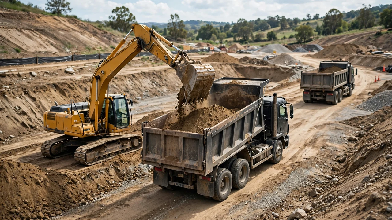
A pond excavation is only half measured when the bank volume is known. The other half is the haulage and ordering plan: how many truckloads the loose soil fills, which soil stays on site, and which materials arrive on trucks. This guide starts where the measurement guide ends, with a loose volume in hand.
How many truckloads will a pond excavation take?
Divide the loose volume by the hauler's stated usable capacity per load, then round up. A 195 yd³ loose clay dig with a hauler-quoted 10 yd³ per load takes 20 loads. The hauler's figure is a quote, not a constant, so confirm it before the first truck is booked.
Loads = loose volume ÷ usable capacity per load, rounded up
Usable capacity is the smaller of two limits: the truck's box volume and the legal payload divided by the loose unit weight of the soil. Legal payload is the truck's gross vehicle weight rating minus its empty (tare) weight. On the U.S. Interstate System the federal limit is 80,000 lb gross vehicle weight, with 20,000 lb on a single axle and 34,000 lb on a tandem axle (23 CFR 658.17); state limits govern other roads. Because you cannot compute payload without the truck's tare weight, ask the hauler for the usable capacity per load in writing and keep it as a stated assumption.
What do you need before ordering trucks?
Collect these inputs before the first phone call:
- The loose volume, recorded separately for each soil stream (the measurement guide gives bank volume; the soil guide gives the swell range that turns it loose).
- The hauler's stated usable capacity per load, in the same units as the loose volume.
- The truck's tare weight and GVWR if any weight check applies, plus the road limits on the haul route.
- The topsoil quantity and the subsoil quantity, kept as separate streams.
- The on-site reuse plan: berm or placed fill that stays, and the export quantity that leaves.
- The loading and staging area, sized before trucks arrive.
Worked example: clay, imperial
A staked pond measures 150 yd³ bank, all clay. The project record supports 30% swell, inside the 20-40% planning range for clay.
- Loose volume = 150 × 1.30 = 195.0 yd³.
- The hauler quotes a usable capacity of 10 yd³ per load. This is the stated assumption; it is not a universal truck size.
- Loads = 195.0 ÷ 10 = 19.5, rounded up to 20 loads.
- Check: 195.0 ÷ 1.30 = 150.0 yd³ bank, which matches the measured input.
Worked example: sand, metric
A pond measures 110 m³ bank, all sand. The project record supports 25% swell, inside the 20-30% planning range for sand.
- Loose volume = 110 × 1.25 = 137.5 m³ (179.84 yd³).
- The hauler quotes a usable capacity of 8 m³ per load. This is the stated assumption.
- Loads = 137.5 ÷ 8 = 17.1875, rounded up to 18 loads.
- Check: 137.5 ÷ 1.25 = 110.0 m³ bank, which matches the measured input.
How do you work the loads into a soil bank balance?
Only the export stream goes on trucks. Credit everything that stays on site before ordering haulage:
| Stream | Fate | How to count it |
|---|---|---|
| Berm soil | Stays on site | Planned volume at placed density; subtract from the export stream |
| Placed fill for low spots | Stays on site | Compacted volume; order the shortfall only |
| Suitable subsoil | Leaves the site or goes to a second reuse | Loose volume ÷ stated load capacity |
| Topsoil | Stays for finish grading | Separate load count; never mixed into the fill order |
| Unsuitable soil or rock | Export | Loose volume with its own swell value; check disposal terms |
Why do topsoil and subsoil need separate load counts?
Topsoil is a finishing material. It feeds final grading, seeding, and planting around the pond, and it performs poorly as structural fill or a pond seal. Subsoil goes to berms, placed fill, or export. One load count that mixes both streams overstates the fill you have and understates the topsoil you will need back later. Strip topsoil first, stockpile it separately, and schedule its loads on its own line of the plan.
How do you schedule loads against the dig?
Book the loading zone before the first truck. Keep excavated spoil and equipment at least 2 feet from the excavation edge (OSHA 29 CFR 1926.651(j)(2)); that rule constrains where stockpiles and waiting trucks can sit. When mobile equipment works near the edge and the operator lacks a clear direct view of it, a warning system of barricades, signals, or stop logs is required (1926.651(f)). Workers must stay clear of, or be protected from, vehicles being loaded or unloaded (1926.651(e)). Size the staging area from the on-site spoil estimate; the stockpile guide shows how to work stockpile volumes from their shape.
Sequence the plan so the dig never waits on trucks and trucks never wait on the dig: confirm the day's load count the evening before, keep the export stream separated from the topsoil stream in the loading sequence, and hold one buffer slot for the last partial loads that swell rounding creates.
How do you plan compaction for placed fill?
Fill placed around a pond, in berms, or in low spots is compacted in relatively thin lifts of 150-200 mm (6-8 in), each compacted with heavy equipment (Recycled Materials Resource Center, FHWA pooled-fund guidance). Compaction shrinks the placed volume below the loose volume, so the order for imported fill is the compacted design volume plus a handling allowance, never the loose volume straight off the truck. The lift thickness, density target, and acceptance test come from the project specification, not from a general rule.
How much liner and underlayment do you order?
For a simple rectangular pond, supplier sizing guidance gives:
Liner length = pond length + 2 × max depth + stated overlap
Liner width = pond width + 2 × max depth + stated overlap
The overlap covers the anchor trench and edge fixing. A stated 2 ft (0.5-1 m) total overlap is a planning assumption, not a standard; confirm it with the liner supplier and state it on the order.
Worked example: liner sizing
A 20 × 12 ft pond, 4 ft maximum depth, stated 2 ft overlap:
- Liner length = 20 + (2 × 4) + 2 = 30 ft.
- Liner width = 12 + (2 × 4) + 2 = 22 ft.
- Area = 30 × 22 = 660 ft² = 73.33 yd².
Check by reversing: 30 - 2 - (2 × 4) = 20 ft and 22 - 2 - (2 × 4) = 12 ft, which recover the pond dimensions. Order liner and underlayment against the supplier's sheet sizes; irregular ponds need the tape-measure layout method rather than this rectangle approximation.
Common mistakes in pond haulage ordering
- Ordering loads from the bank volume and forgetting swell: the trucks carry loose volume, which is larger by the swell percentage.
- Treating one truck capacity as universal. Capacity is quoted per hauler, per truck, and it can shrink under legal payload limits.
- Skipping the payload check. The federal Interstate limit is 80,000 lb GVWR; the hauler's box may hold more volume than the legal payload allows.
- Mixing topsoil into the export count, then discovering the finish-grading soil is gone.
- Quoting a cost per cubic yard from a web article. Published figures conflict because their scopes differ (haul-only versus disposal-included); current costs come from current local quotes.
Safety and professional scope
OSHA trenching and excavation provisions apply to U.S. workplaces; excavation safety, spoil placement, and haul-road planning follow the standard, permits, and the competent person on site. Quantity planning does not replace an excavation safety plan, project drawings, specifications, permits, codes, or a qualified professional. Where pond design affects drainage, groundwater, or a dam, a licensed engineer owns those decisions.
Sources and scope
- OSHA 29 CFR 1926.651 (trenching and excavation requirements): edge setback for spoil and equipment, warning systems near the edge, and protection around loaded vehicles. U.S. workplace scope.
- 23 CFR 658.17 (Federal Highway Administration): 80,000 lb maximum gross vehicle weight on the Interstate System, 20,000 lb single axle, 34,000 lb tandem. Interstate and reasonable access only; states set other road limits.
- Recycled Materials Resource Center (FHWA pooled-fund), embankment/fill guidance: fill placed and compacted in 150-200 mm (6-8 in) lifts. Embankment practice; project specification governs.
- smart-pond.com, liner sizing guidance: liner length and width formulas with stated overlap. Supplier guidance, not a standard.
- Engineering Toolbox, "Soil and Rock - Bulk Factors": swell planning ranges (clay 20-40%, sand 20-30%). Planning ranges only; project values need verification.
- NIST Handbook 44, 2026 Appendix C: unit relationships (1 m³ = 1.30795 yd³ = 35.3147 ft³; 1 yd³ = 27 ft³; 1 ton = 2,000 lb).
Review responsibility: Saleem Sial owns the published calculation, source, and editorial checks. Waseem Sial, External Reviewer and Engineer, remains listed for ongoing external review; no completed external-review date is claimed.
Next, read the pond measurement guide for the field numbers this article's loads start from, the soil considerations guide for the swell ranges used above, or return to the Earthwork & Drainage Calculators hub.